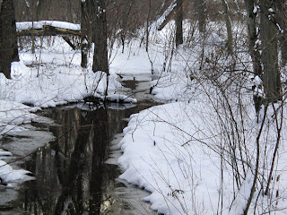
Here is a nice winter scene to commemorate our first major snow of the year. I took this image a few years ago right after a larger snowstorm. It shows a bufflehead duck swimming across a nearby pond. Its striking white and black markings allowing it to blend into the snowy landscape.
The bufflehead is one of several duck species that breed in the lakes of the great boreal forests of Canada and then fly south to the Chesapeake Bay region. While hundreds of thousands of ducks still winter in the area, their numbers have decreased in the past half century, mainly due to degradation of the Bay.
View more winter photographs in my gallery.
Saturday, January 31, 2009
Sunday, January 25, 2009
Maryland Statehouse, Annapolis
With the Maryland General Assembly having started its session, I decided to go out to Annapolis yesterday and take some photographs of the Maryland Statehouse. I got this interesting image of the Statehouse cupola with the state flag in the foreground.
The Maryland League of Conservation Voters is hosting an Environmental Summit and Legislative Kick-Off on Monday, January 26th at the capitol. The meeting will include presentations from top state officials, expert briefings on the top environmental issues, and information about the MDLCV's legislative priorities. See their website for more information.
View other galleries
Saturday, January 17, 2009
The Capitol
Less than four days are left until the historic inauguration of Barack Obama as our new President. With an array of troubles, the nation waits and hopes for new era of better government. Among those hopes are the desire for a progressive energy policy and a scientifically grounded environmental policy. Let send our prays and thoughts out for our new President.
This stylized image protrays the monuments of the National Mall taken from near the Iwo Jima Memorial at sunset. From right to left, the Lincoln Memorial, the Washington Monument, and the US Capitol Building. Its based on a photograph taken back in '04.
View other galleries
Monday, January 12, 2009
American Bald Eagle
This photo was taken on the Eastern Shore of Maryland at the Pickering Creek Audubon Center in February '08. Taken with a 300 mm lens while the eagle soared some several hundred feet above the shoreline. The image was not quite as sharp as I liked so I intentionally added a canvas texture to give it the feel of a painting.
The bald eagle population has recovered well since the worst days of the 1950's and 1960's when the population was devastated by the effects of the pesticide DDT. From a low of 487 nesting pairs in the "lower 48" in 1963, there are now estimated to be over 12,000 nests. The Chesapeake Bay is home to one of the higher concentrations of eagles outside of Alaska. The eagles where removed from the Endangered and Threatened Species List in 2007 however the greatest threat today is continued habitat loss to development.
View other galleries
New Direction
I'm changing the focus of this blog slightly to show a Picture of the Week while still focusing on the conservation message of the photo. I hope you enjoy and welcome feedback.
- Rogard
- Rogard
Thursday, January 1, 2009
South River Greenway
I've been following efforts to establish the South River Greenway in Anne Arundel County. Although I have been most active in the Maryland's flagship Patuxent Watershed, my home is actually just across a ridgeline in the more compact South River Watershed. While the broad, tidal South River stretches to the Chesapeake Bay south of Annapolis, the upper watershed reaches up a series of small creeks and streams between wooded ridges from Annapolis out to Davidsonville, Crofton, and Millersville.
In a prime location between Annapolis, Baltimore, and Washington D.C., development pressure in the area is high. Much of the tidal river's shoreline is already developed, as is the western boundary in Crofton. Other subdivisions weave through the area, particularly along Rt 450 which bisects the watershed. Yet much of the land is still rural, consisting of small farms, 800 acres of wetlands and 6000 acres of undeveloped forests. The state, county, and Annapolis city own 2500 acres of land and many more acres are protected by forest conservation easements.
The Scenic Rivers Land Trust, a local Anne Arundel based organization, is leading the effort to expand protection for the area. The SRLT is hosting a set of meeting on the Greenway on January 22nd
Links:
Fact Sheet
Scenic Rivers Land Trust received a grant award of $50,000
Subscribe to:
Posts (Atom)